Catalog Archive
Auction 174, Lot 494

"Plan Topo-Hydrographique de la Baye de Gibraltar...", Lattre, Jean

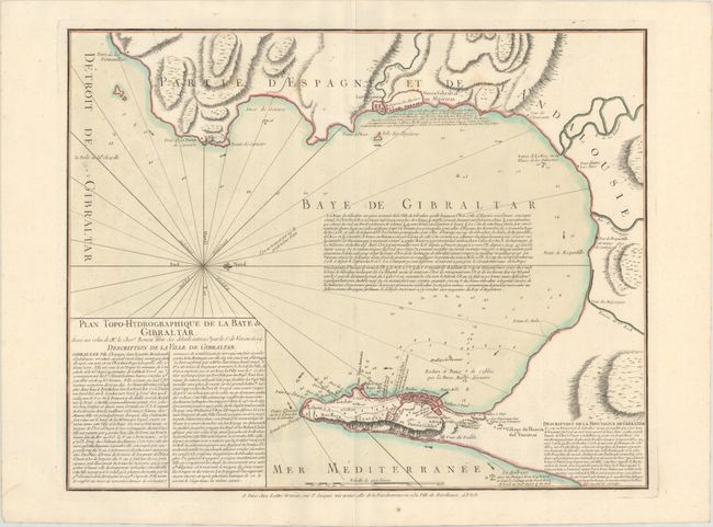
Subject: Bay of Gibraltar

Period: 1756 (circa)

Publication:

Color: Hand Color

Size:
22.2 x 17.4 inches
56.4 x 44.2 cm
Download High Resolution Image
(or just click on image to launch the Zoom viewer)

This detailed chart based on the work of cartographer Louis Claude de Vezou focuses on the fortified port of Gibraltar and the surrounding Bay of Gibraltar. There are extensive notes regarding the city, bay and rock of Gibraltar. The bay is filled with soundings, anchorages, ocean currents. A lovely and uncommon chart.

References:

Condition: B+

Contemporary color on paper with a large medallion watermark, a few spots of foxing, and very light soiling. A short tear in the left blank margin has been closed on verso with old paper.

Estimate: $300 - $400

Sold for: $180

Closed on 9/11/2019

Archived