Subject: Yorkshire, England
Period: 1610 (dated)
Publication: The Theatre of the Empire of Great Britaine...
Color: Hand Color
Size:
20.4 x 15.4 inches
51.8 x 39.1 cm
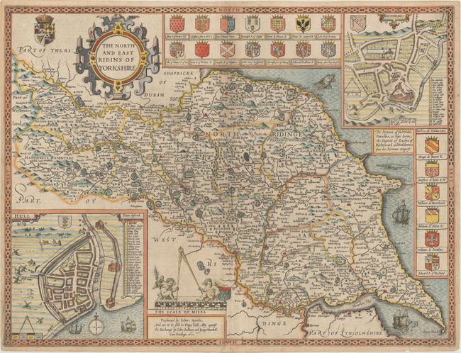
This stunning and uncommon map of North and East Yorkshire is divided into wapentakes and locates towns, cities, rivers, forests, hills, and parks. Ships and sea monsters appear in the seas. The Humber River is prominently depicted. Detailed inset plans of Richmond and Hull fill the top right and bottom left corners, respectively. The coats of arms of noble families of Richmond and Holdernes are featured at top and right. An ornate title cartouche and the coats of arms of the Union of Crowns decorate the top left corner. Two putti with a giant compass and another coat of arms sit atop the scale of miles. Engraved by Jodocus Hondius. English text on verso, published by John Sudbury and George Humble.
References: cf. Shirley (BL Atlases) T.SPE-1b.
Condition: B+
A nice impression on a watermarked sheet with light soiling and a centerfold separation at bottom that has been repaired on verso with archival materials. A few edge tears just enter into the neatline at top and bottom.