Subject: North Atlantic
Period: 1776 (dated)
Publication:
Color: Black & White
Size:
30.9 x 22 inches
78.5 x 55.9 cm
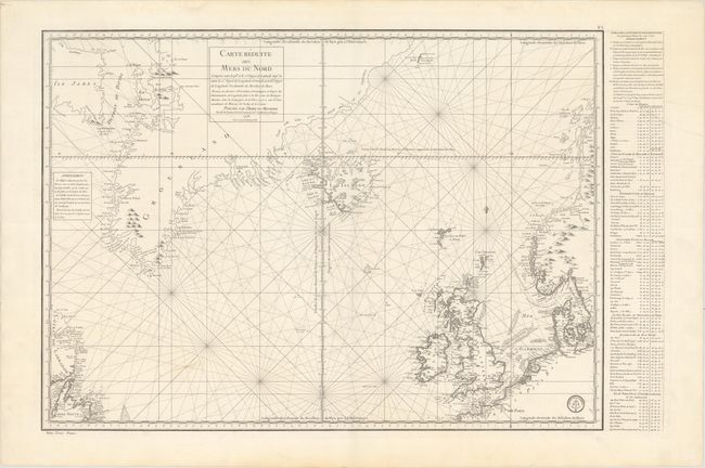
This sea chart of the northern Atlantic is centered roughly on Iceland. It covers from Labrador, Newfoundland, and Baffin Island (Ile James) to Norway, and includes Greenland, Great Britain, Denmark, and part of the coast France, inland to Paris. It is a fine chart with fleur-de-lis and rhumb lines and a table of coordinates for major locations at right.
In the years 1771-1772 the French government sent a scientific expedition led by Verdun de la Crenne to the North Atlantic. Their commission was to explore the ocean, coasts, and islands and correct errors on existing charts and test various ways of measuring latitude and longitude. One of the most significant corrections they made was in the location of Iceland; based on their measurements they moved the country three and a half degrees eastwards.
References:
Condition: B+
A fine impression on thick paper with a "Depot de la Marine" watermark. There is a 3.5" centerfold separation at center that has been closed on verso with archival tape and a light streak of soiling.