Catalog Archive
Auction 174, Lot 288

"Pictorial Map of the Republic of Panama with the Canal Zone",
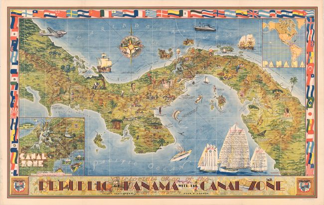
Subject: Panama

Period: 1941 (circa)

Publication:

Color: Printed Color

Size:
46.2 x 28.8 inches
117.3 x 73.2 cm
Download High Resolution Image
(or just click on image to launch the Zoom viewer)

This pictorial map was created by Clark Teegarden and John F. Herman, who were employed as architects in the "Canal Zone" in Panama. The Canal Zone was an unincorporated territory of the United States between 1903-79 that granted the US control over this region due to its involvement in the construction and management of the canal. Teegarden and Herman created this map "as a souvenir for American servicemen" (Hornsby) stationed in Panama. The map is filled with imagery of the flora, fauna, history, and culture of Panama. Additional information on the history and weather of the country are displayed on the sails of several ships in the Pacific Ocean. Two inset maps depict the Canal Zone in greater detail, as well as a map of the western hemisphere that demonstrates the importance of the Panama Canal to global shipping. The map is surrounded by colorful flags from many nations. Lithographed by Ridgway Litho. Co. in Seattle. For more details on this map and its creators, read Rodrick Barron's excellent article here.

References: Hornsby (Picturing America) pp. 45, 118 & 177; Rumsey #8521.000.

Condition: A

There are professional repairs to some small separations along the folds and to short tears along the edges of the sheet.

Estimate: $475 - $600

Sold for: $350

Closed on 9/11/2019

Archived