Subject: Central America
Period: 1821 (circa)
Publication: New General Atlas
Color: Hand Color
Size:
24.3 x 20 inches
61.7 x 50.8 cm
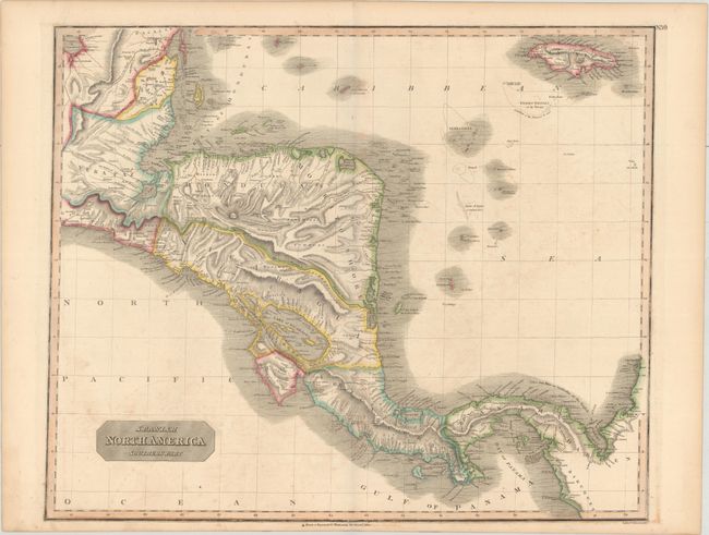
Large and very detailed map of the region south of the Yucatan Peninsula to South America. Includes Belize, much of Guatemala, El Salvador, Honduras, Nicaragua, Costa Rica, Panama and Jamaica. There is excellent detail of inland regions with lakes, rivers and mountains, and many offshore islands are depicted. Two non-existent islands appear in the Bay of Honduras: Misteriosa and Santanilla. In addition to its historical appeal, the dramatic topography and coastal shading of this map give it great aesthetic appeal. Engraved by William Dassauville.
References: Kapp (MCC-106) #91.
Condition: B+
Contemporary color with light offsetting and scattered foxing.