Catalog Archive
Auction 174, Lot 283

"Carte des Provinces de Tabasco, Chiapa, Verapaz, Guatimala, Honduras et Yucatan", Bellin, Jacques Nicolas

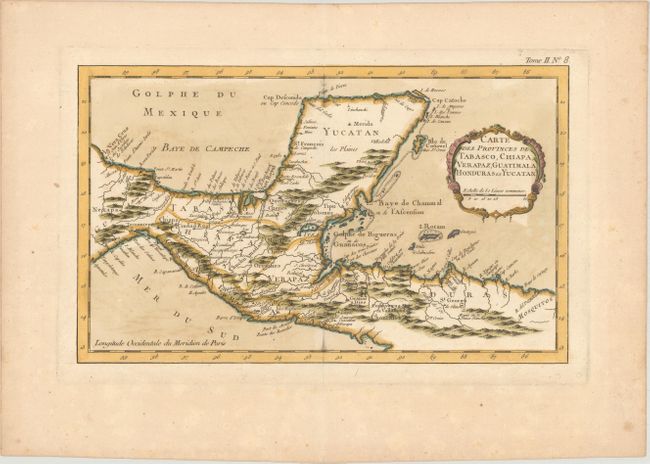
Subject: Central America & Southern Mexico

Period: 1764 (circa)

Publication: Le Petit Atlas Maritime

Color: Hand Color

Size:
13.4 x 8.1 inches
34 x 20.6 cm
Download High Resolution Image
(or just click on image to launch the Zoom viewer)

Nice detailed map of the Yucatan peninsula and northern Central America. Locates primary harbors, shoals and offshore islands including Cosumel, Ruatan and Bonacca. Guatemala is limited to a narrow strip along the Pacific coast and El Salvador has yet to be carved out of Honduras. Decorated with a fine title cartouche.

References: Kapp (MCC-103) #45 plate X.

Condition: B+

Watermarked paper with light offsetting and toning.

Estimate: $100 - $130

Sold for: $50

Closed on 9/11/2019

Archived