Subject: World
Period: 1725 (circa)
Publication:
Color: Hand Color
Size:
12.2 x 6.9 inches
31 x 17.5 cm
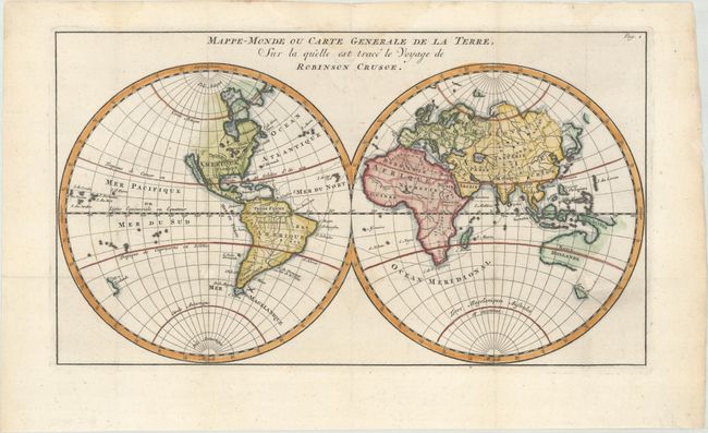
This small, uncommon map of the world was designed to trace the route of Robinson Crusoe, the fictional character from the novel by Daniel Defoe. First appearing in 1719, The Life and Strange Surprizing Adventures of Robinson Crusoe was initially published as written by Crusoe himself, leading many to believe he was a real person. This map shows Crusoe's route through the Atlantic and Indian Oceans. Geographically, the map continues several geographical misconceptions that were prevalent at the beginning of the 18th century. California is shown as an island and Greenland is still connected to Canada. Japan is shown as one elongated island, with another partially delineated landmass to the east. A number of areas remain uncharted, including the northwest coast of North America and much of Australia and New Zealand.
References:
Condition: B+
A bright sheet, issued folding on watermarked paper with professional repairs to several small holes at fold intersections and faint damp stains along the top edge of the sheet.