Subject: World
Period: 1722 (dated)
Publication: Atlas ou Recueil de Cartes Geographiques...
Color: Hand Color
Size:
27.5 x 18 inches
69.9 x 45.7 cm
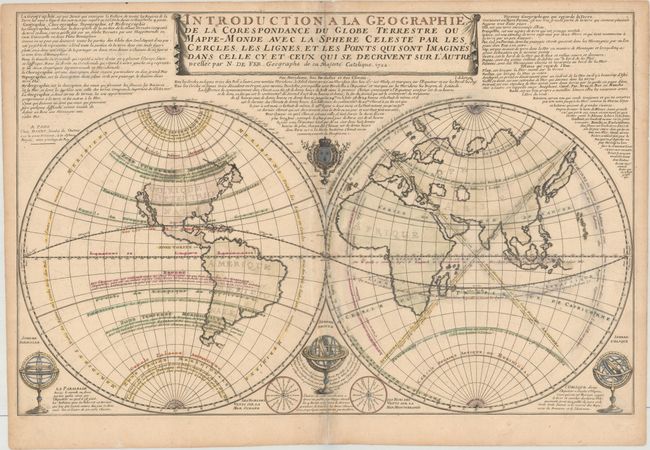
This large and boldly engraved double-hemispheric map shows California as an Island. The continents are devoid of information as the focus of this map are the geographical terms associated with a terrestrial globe, such as latitude and longitude, circles of latitudes, temperate zones, antipodes, etc. The lengthy note at top describes the globe and the various terms used to describe both geography and the globe. Three armillary spheres illustrate additional terms, while two wind roses name the winds in the oceans and the Mediterranean Sea. A very uncommon map.
References: Pastoureau, FER II C [4].
Condition: B
A crisp impression on watermarked paper with contemporary outline color, light toning along the centerfold, minor soiling, and some chalk residue on recto. There are archival repairs to some small holes in the eastern hemisphere and a centerfold separation that enters 1" into image at bottom.