Subject: Plymouth, Massachusetts
Period: 1929 (dated)
Publication:
Color: Black & White
Size:
14.9 x 20.9 inches
37.8 x 53.1 cm
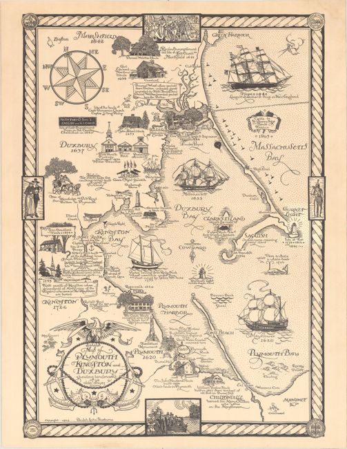
This tourist map depicts the coastline from Duxbury to Plymouth and highlights the landmarks "of ye olde days" throughout the region. Filled with historical facts and images of historic homes, this map serves as the perfect guide to any history buff's tour though the area. The Mayflower is depicted in Plymouth Bay and a vignette of the first settlers to arrive on the ship is included at bottom center. A large compass rose orients north to the top left of the map. Created by Beulah Locke Sherburne, a native of Lexington, Massachusetts.
References: Rumsey #12381.
Condition: A
Issued folding, with minor toning. Stamped by So. Shore Editorial Service in Millbrook, MA on verso.