Catalog Archive
Auction 174, Lot 202

"Map of the Country Between Yampa & White Rivers (For General Reference) to Accompany the Report of Gust. R. Bechler", Bechler, Gustavus R.

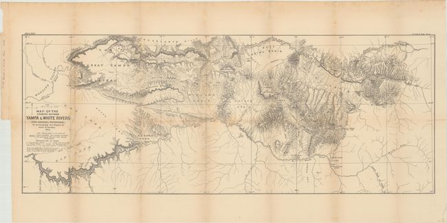
Subject: Northwestern Colorado

Period: 1876 (dated)

Publication:

Color: Black & White

Size:
29.8 x 11.5 inches
75.7 x 29.2 cm
Download High Resolution Image
(or just click on image to launch the Zoom viewer)

A highly detailed map of the northwestern corner of the state, issued in the same year as statehood. Depicts the rugged topography of the region between the White and Yampa rivers, and extends into Utah where the Yampa meets the Green River. The White River Agency appears to be the only inhabited site named. Several trails are noted, including the "Trail between Uintah and White River Indian Agencies." Ravens, Powells, and Simpsons Parks are noted, as is the Great Yampa Plateau, Axial Basin, and Coyote Basin.

References:

Condition: B

Issued folding with light toning and scattered foxing along the fold lines. There are a few tiny splits at fold intersections.

Estimate: $100 - $130

Sold for: $60

Closed on 9/11/2019

Archived