Subject: Southern California, Oil
Period: 1906 (dated)
Publication: Bulletin No. 309
Color:
A wonderful group of maps illustrating the California oil boom during the early 20th century:
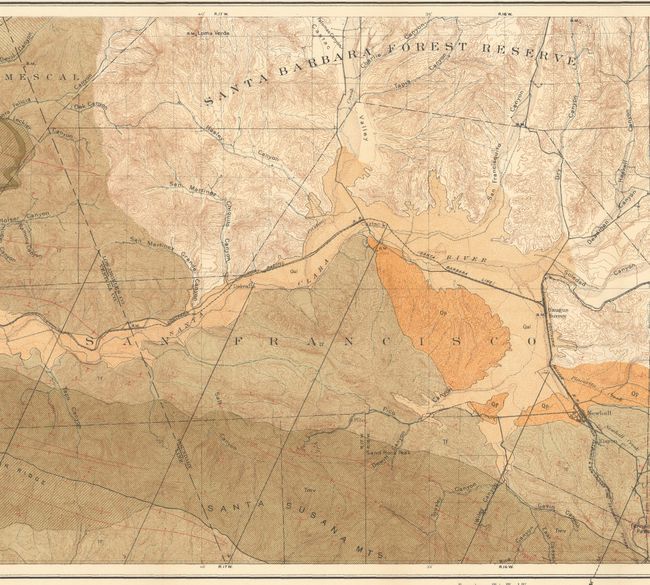
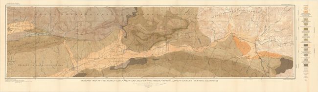
A. Geologic Map of the Santa Clara Valley and Adjacent Oil Fields, Ventura and Los Angeles Counties, California, printed color (48.2 x 12.3"). An attractive geological map of the Santa Clara valley, one of the early centers of the California petroleum industry. It is color-coded to identify 12 different geological types as well as fault lines and oil wells. In addition to the geology, the map provides valuable information on a number of early mountain roads, canyons, and small early settlements in the region.
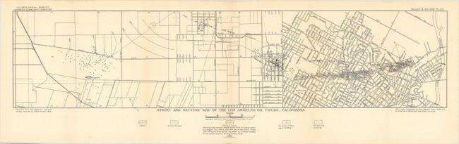
B. Street and Section Map of the Los Angeles Oil Fields, California, black & white (26.5 x 6.0"). This map shows a remarkable number of oil wells in downtown Los Angeles primarily from the L.A. River to Westlake Park. This map was featured in the Library of Congress exhibition on "Los Angeles Mapped" with the following description: "Edward L. Doheny's 1892 discovery of oil near downtown Los Angeles led to an oil boom around the turn of the twentieth century. Hundreds of wells were dug throughout the city, often in the front or backyards of residences."
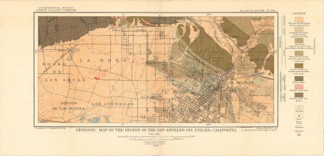
C. Geologic Map of the Region of the Los Angeles Oil Fields, California, printed color (13.8 x 6.5"). Prominently depicts the oil fields downtown and locates the famous La Brea Tar Pits further to the west. Identifies 8 different geological types on the map.
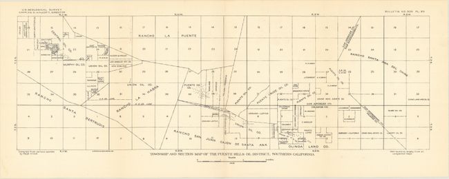
D. Township and Section Map of the Puente Hills Oil District, Southern California, black & white (20.2 x 6.6"). Shows land ownership in the Puente Hills region near the intersection of Los Angeles, Orange, and San Bernardino counties. Much of the land is owned by oil companies including Union Oil, Puente Oil, and Murphy Oil to name a few.
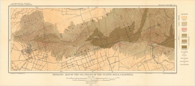
E. Geologic Map of the Oil Fields of the Puente Hills, California, printed color (17.1 x 6.9"). Locates the numerous oil wells to the east of Whittier and identifies 6 geological types on the map.
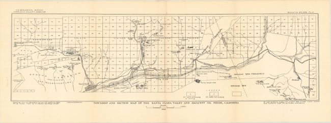
F. Township and Section Map of the Santa Clara Valley and Adjacent Oil Fields, California, black & white (21.9 x 6.3"). Township map of the Santa Clara valley extending from Nordhoff to Newhall and south to Santa Paula. A legend identifies producing and non-producing oil wells and several oil company holdings are identified.
References:
Condition: A+
Fine. Issued folding.