Subject: Southwestern United States
Period: 1958 (circa)
Publication:
Color: Black & White
Size:
21.1 x 12.1 inches
53.6 x 30.7 cm
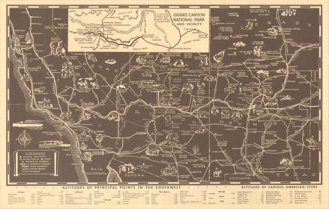
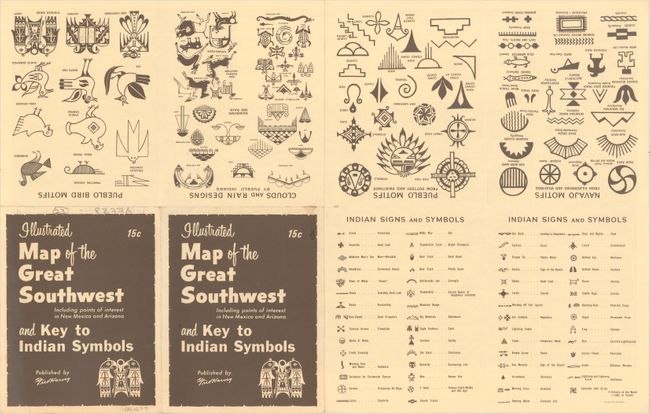
This pictorial tourist map of the American Southwest covers New Mexico, Arizona, much of Colorado, Nevada, and California, and parts of Utah and northern Mexico. Towns and cities, roads, rivers, and railroads are identified, but the main attraction is the small illustrations of attractions that fill the landscape, including the Grand Canyon, Roosevelt Dam, Rainbow Bridge, Carlsbad Caverns, the Painted Desert, Mesa Verde National Park, Death Valley, and much more. There is an inset at top that zooms in on the area surrounding the Grand Canyon National Park. Indian pueblos are located. Tables at bottom compare the altitudes of principal points in the Southwest with those of various American cities. The verso features extensive keys covering various Navajo and Pueblo signs, symbols, and motifs. Published by the famous Fred Harvey Company, whose partnership with the Santa Fe Railway first mobilized the tourist industry in the Southwest. Folds into a brochure, with the title on the cover.
References:
Condition: A
Issued folding with some very minor wear along the horizontal fold.