Subject: Central United States
Period: 1839 (published)
Publication: H.R. Doc. 128, 25th Congress, 3rd Session
Color: Black & White
Size:
29.1 x 17.8 inches
73.9 x 45.2 cm
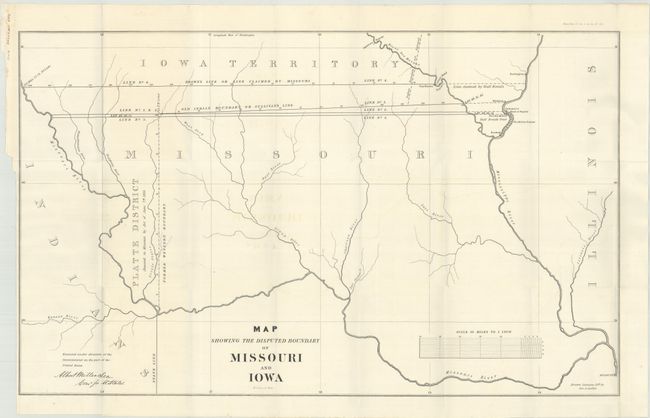
This is the first edition of this most interesting map that shows the disputed boundaries between Missouri and Iowa, including a related dispute over the Half Breed's Tract for a piece of land between the Mississippi and Des Moines Rivers. Various versions of the two major lines, namely Brown's Line or Line Claimed by Missouri and Old Indian Boundary or Sullivan's Line, are detailed. The Platt District annexation of 1836 is also delineated. Drawn by George A. Leakin and lithographed by W.J. Stone and signed in the stone "Albert Miller Sea Comr. for U. States." It was also published in a letter from the Secretary of State from the December 31, 1842 report titled the "Northern Boundary of Missouri."
References: Claussen & Friis #300.
Condition: A
Issued folding on a bright sheet with a bit of faint offsetting.