Subject: Western Hemisphere - America
Period: 1598 (dated)
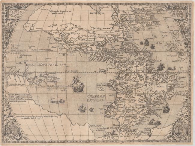
Publication: Botero’s Relaciones Universales del Mundo
Color: Black & White
Size:
18.4 x 13.6 inches
46.7 x 34.5 cm
This striking map is from a rare Spanish translation of Botero’s geographical and political commentary, published in 1603. Thus it is one of the few maps to be published in Spain during the sixteenth and early seventeenth centuries. The map is based on the work of Abraham Ortelius, but with a new decorative surround incorporating medallions with the portraits of Vespucci and Columbus, a simpler title cartouche, and the addition of several ships and a sea monster. It depicts the earlier portrayal of the Americas, including the characteristic bulge in South America. North America is elongated with spurious lakes and rivers in the interior. The Atlantic is filled with fictitious islands, including Frislant, S. Brandan, and Sept cites. The huge southern continent encompasses Tiera del Fuego and Noeva Ginea.
References: Burden #129.
Condition: B
A dark impression, issued folding and now flattened with professional repairs to a number of fold separations, a couple of small holes along the folds with minute loss of image, and to a 7" tear at left that has been inconspicuously repaired. The margins have been extended a bit with period-correct paper to accommodate framing.