Subject: Cartographic Miscellany, Germany, World War II
Period: 1945 (dated)
Publication:
Color: Printed Color
Size:
28 x 41 inches
71.1 x 104.1 cm
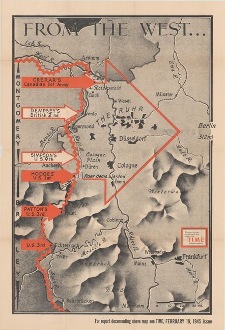
This fascinating World War II map is an enlarged version of one that was included in the February 19, 1945 issue of Time Magazine. It graphically depicts the region adjacent to the Rhine River from approximately Frankfurt to Arnhem, Netherlands with north oriented at top left. Allied forces from the United States, Canada, and Britain are prominently depicted with red and white arrows advancing along the German border. A larger outline arrow funnels the offensive efforts to Berlin, which is noted as being 312 miles to the east.
References:
Condition: B+
Issued folding with a nearly invisible 2" tear at center that has been closed on verso with archival tape. There is some minor staining along the lower fold and a few minor splits at fold intersections.