Subject: Africa
Period: 1822 (dated)
Publication: Spehr's Geographischer Universal-Atlas
Color: Hand Color
Size:
15.3 x 11.2 inches
38.9 x 28.4 cm
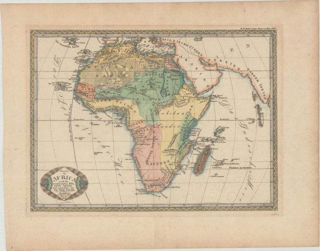
This rare atlas map of Africa by Braunschweig-based mapmaker Friedrich Wilhelm Spehr was published in Spehr's Geographischer Universal-Atlas. It features political divisions, place names, and some nice topographical detail. The Sahara Desert is rendered as a series of sand-like fine dots. The sources of the Nile appear north of the Monas Gebirge, a mountain range in present-day Ethiopia. There is no sign of Lake Victoria, but there is an incomplete lake called Maravi around where Lake Malawi is located. A large portion of Central Africa is labeled Unbekant Lander ("unknown land"). Drawn by L. Schulze.
References:
Condition: A
On a watermarked sheet with faint stains and minor toning. There are remnants of hinge tape on verso.