Catalog Archive
Auction 173, Lot 407

"A New & Accurate Map of China, Drawn from Surveys Made by the Jesuit Missionaries, by Order of the Emperor. The Whole Being Regulated by Numerous Astronomical Observations", Bowen, Emanuel

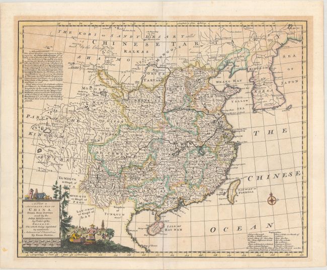
Subject: China & Korea

Period: 1747 (circa)

Publication:

Color: Hand Color

Size:
16.6 x 13.6 inches
42.2 x 34.5 cm
Download High Resolution Image
(or just click on image to launch the Zoom viewer)

This finely engraved map shows China and Korea, with detail focused primarily in China. It was derived from the Jesuit survey of 1708 to 1717. Text at left details these surveys, and a key at bottom right provides the meaning of relevant Chinese words. The map is embellished with a pictorial title cartouche depicting figures in regional dress at bottom left. A small compass rose appears in the Chinese Ocean. This example, without a page number, either appeared in Bowen's A Complete System of Geography… or The Maps and Charts to the Modern Part of the Universal History... (published in 1766).

References: McCorkle (18th C. Geography Books) #17-11 (Vol 2); cf. Shirley (BL Atlases) T.BOW-2d #28.

Condition: B+

A crisp impression with light toning that is more predominant at top.

Estimate: $200 - $230

Sold for: $150

Closed on 6/5/2019

Archived