Catalog Archive
Auction 173, Lot 401

One of the Earliest Maps of Taiwan

"Die Insel Formosa Neu Abgemessen auf Befehl Kaysers Kahmi", Stoecklein, Joseph
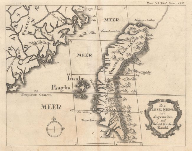
Subject: Taiwan

Period: 1726 (circa)

Publication: Brief, Schriften und Reis Beschreibungen...

Color: Black & White

Size:
9 x 7.1 inches
22.9 x 18 cm
Download High Resolution Image
(or just click on image to launch the Zoom viewer)

This very uncommon map of Taiwan is one of the earliest maps of the island. The map depicts the western portion of the island, with the Central Mountain Range and several towns shown, including Keelung and Tainan. Interestingly, a conjectural coastline extends northeast of Keelung, demonstrating the lack of knowledge of the island at the time. Decorated with a title cartouche and simple compass rose.

References:

Condition: A

A dark impression on watermarked paper with a hint of toning along the centerfold and several damps stains in the bottom margin, well away from the image. There are a couple of small chips also along the bottom edge of the sheet.

Estimate: $1,100 - $1,400

Sold for: $800

Closed on 6/5/2019

Archived