Subject: Southeastern Europe, Hungary
Period: 1747 (circa)
Publication: A Complete System of Geography…
Color: Black & White
Size:
16.8 x 13.6 inches
42.7 x 34.5 cm
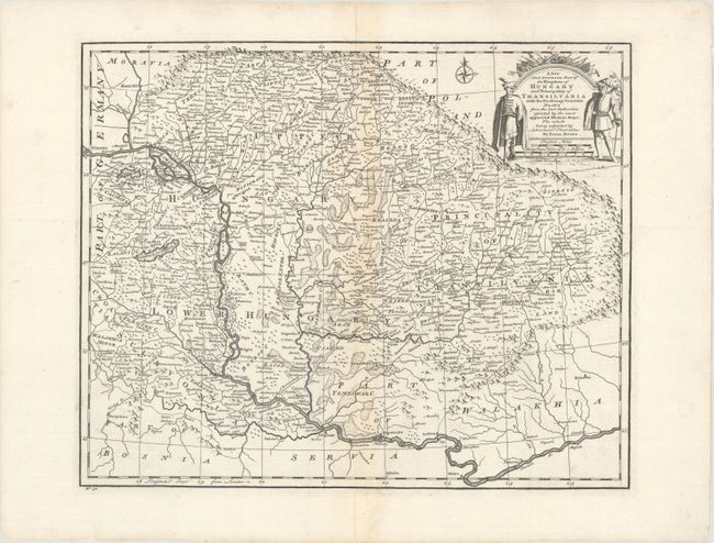
This finely engraved map of Hungary extends to include parts of Romania, Slovakia, and Serbia. It stretches as far west as Vienna and as far south as Belgrade. The map is filled with detail and notations and shows an extensive systems of roads. The Banat of Temeswar in the southern portion of Hungary, was established by the Treaty of Passarowitz in 1718, in which the Ottoman Empire ceded the region to the Habsburg Monarchy of Austria. The southern part of the Banat of Temeswar was again ceded back to the Ottomans in the Treaty of Belgrade in 1739. The decorative title cartouche features two military officers, flags, and weaponry.
References: McCorkle (18th C. Geography Books) #17-28 (Vol I); cf. Shirley (BL Atlases) T.BOW-2a #30.
Condition: B+
A crisp impression with light toning along the centerfold and a few professionally repaired tears and centerfold separations.