Subject: Russia, Baltic States
Period: 1788 (circa)
Publication:
Color: Hand Color
Size:
24.5 x 17.5 inches
62.2 x 44.5 cm
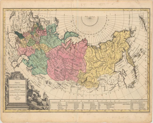
This is the uncommon reduced version of Lotter's 3-sheet map of Russia, based on the comprehensive surveys of Johann Treskot and Johann Schmidt. Treskot and Schmidt published their groundbreaking 23-sheet survey of Russia in 1776 for the Imperial Academy of Sciences. The map captures the vast expanse of Russia, spanning from the Baltic Sea to Kamchatka. It names towns and cities and features good topographical detail. A table along the bottom identifies 26 political divisions. In the North Pacific, the Aleutian Islands are visible. A decorative title cartouche adorns the bottom left corner.
References:
Condition: B+
A fine impression with some spots of light scattered foxing, a printer's crease at top, and a short edge tear at right that just enters the neatline and has been closed on verso with archival tape. Old tape has been removed from the verso, with light show-through of the residue on recto.