Subject: Ancient World
Period: 1741 (published)
Publication: Description Exacte de l'Univers, ou l'Ancienne Geographie Sacree et Profane
Color: Hand Color
Size:
19.8 x 15.4 inches
50.3 x 39.1 cm
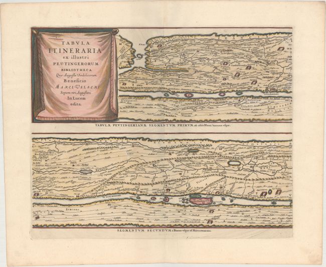
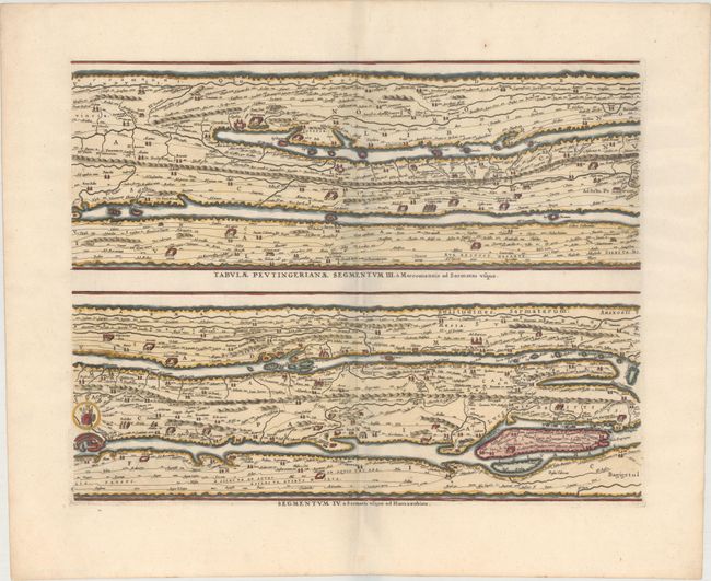
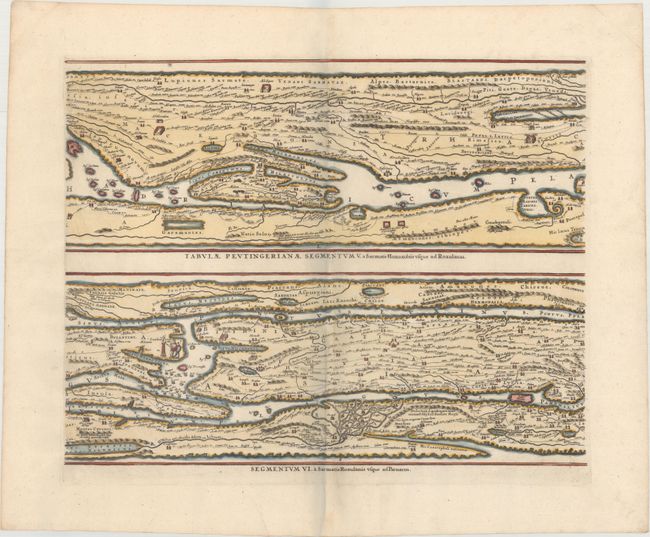
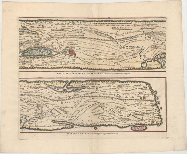
Four sheets making up the famous Peutinger Table, or a Roman road map of the world. The original parchment document was found by Konrad Celtes in a library in Augsburg, came into the hands of Konrad Peutinger and later went to his relative Mark Welser who was the first to publish a copy of it in 1591 at Aldus Manutius in Venice. These maps, based on the original manuscript, were first popularized by Ortelius in 1598 and became an important part of his great historical atlas. Jansson's version is nearly identical to that of Ortelius. These decorative maps, in a sequence of four plates, each with two strip maps, depict the imperial roads and posts within the Roman Empire throughout Europe, North Africa and Asia as far as Toprobana (Sri Lanka). Blank verso, published in Pieter de Hondt's Description Exacte de l'Univers, ou l'Ancienne Geographie Sacree et Profane, a French edition of Georgius Hornius' Accuratissima Orbis Antiqui Delineatio, which included maps from Johannes Jansson's historical atlas and Abraham Ortelius' Parergon.
References: Shirley #393; Van der Krogt (Vol. I) #0940/1-4:1.
Condition: A
Dark impressions on clean, bright sheets with wide margins. The third sheet has a few minor printer's creases at bottom left, and the fourth sheet has a vertical printer's crease near the centerfold.