Subject: Eastern Europe
Period: 1747 (circa)
Publication: A Complete System of Geography…
Color: Black & White
Size:
16.9 x 13.6 inches
42.9 x 34.5 cm
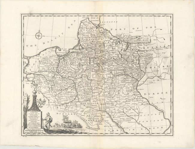
This handsome map covers Poland, Lithuania, Belarus, and parts of Latvia and Ukraine. It delineates political divisions and names many towns and cities, including Warsaw, Krakow, Poznan, Minsk, Riga, and Kyiv. Rivers, mountains, and roads are detailed. Part of the Russian Empire in Europe and Little Tartary in Europe are shown in the east, but there is little detail other than rivers and some city names. A compass rose appears in the Baltic. There is a decorative title cartouche at bottom left with a figure in local dress with a landscape in the background.
References: McCorkle (18th C. Geography Books) #17-27 (Vol I); cf. Shirley (BL Atlases) T.BOW-2a #29.
Condition: B+
A nice impression with light toning along the centerfold and some printer's ink residue.