"Les Estats de la Couronne de Castille, dans les Parties Plus Septentrionales de l'Espagne: et la ou sont les Royaumes de Castille Vielle, Leon, Gallice, Asturie, Biscaie Seignrie. Navarre &c.", Sanson, Nicolas
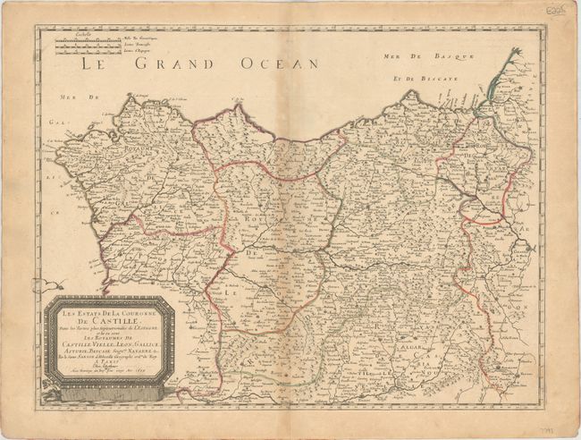
Subject: Northern Spain
Period: 1679 (dated)
Publication:
Color: Hand Color
Size:
20.9 x 15.8 inches
53.1 x 40.1 cm
This finely engraved map covers Castille and its surrounding areas in northern Spain. The map extends as far south as Toledo and as far east as Zaragoza, and it includes portions of France and Portugal. It delineates political divisions and identifies several towns and cities, including Madrid, Bilbao, Pamplona, Leon, and the Portuguese city of Porto. There is nice topographical detail. The title appears in a large picture frame-style cartouche at bottom left. Engraved by Jean Sommer.
References:
Condition: B
Original outline color on a watermarked sheet with light toning primarily along the centerfold and sheet's edges. There is a scratch in the plate along the border at left.