Subject: Northern France & Western Belgium
Period: 1695 (circa)
Publication:
Color: Black & White
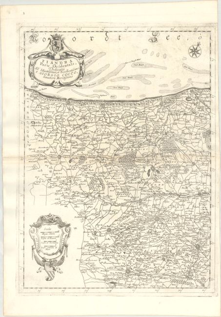
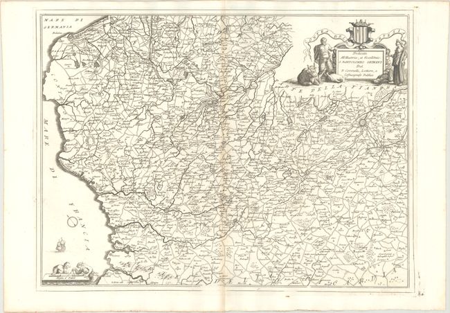
This pair of maps of regions in France is boldly engraved in Coronelli's style and filled with towns, rivers, roads, and topography. This set includes:
A. Flandra Parte Occidentale..., (17.7 x 24.1"). This map extends along the coast from Calais, France to Oostende, Belgium, and as far inland as Douai. The map is adorned with two strapwork cartouches and a compass rose orienting north to the top right.
B. Contea dell' Artesia, (23.9 x 17.8"). This map is oriented with north to the top left and shows the coastline of France from Calais and Gravelines to Abbeville, extending east to Douai. The title cartouche features Pan and Demeter, goddess of harvest.
References:
Condition: B+
Light toning along the centerfolds. The map of Fiandra has the watermark of three crescent moons, and the map of Artesia has the watermark of a simple fleur-de-lis medallion.