Subject: England & Wales
Period: 1610 (dated)
Publication: The Theatre of the Empire of Great Britaine...
Color: Hand Color
Size:
20.4 x 15.3 inches
51.8 x 38.9 cm
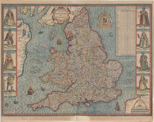
This is Speed's handsome carte-a-figures map of England and Wales, based on the work of Christopher Saxton and filled with details of towns and counties. The map is flanked by male and female pairs, including a lady and nobleman, a gentleman and gentlewoman, a citizen and his wife, and a countryman and his wife. At top right is a table indicating the number of cities, bishoprics, markets, rivers, bridges, etc. in each shire. The map is embellished with two strapwork cartouches, the Royal coat of arms, and several sea monsters and galleons. This is the first state, engraved by Jodocus Hondius, one of the first engravers to incorporate costumed figures as decoration. The imprint credits publishers John Sudbury and George Humble. English text on verso.
References: Shirley (BI to 1650) #318; cf. Shirley (BL Atlases) T.SPE-1b.
Condition: B+
A nice impression on watermarked paper with light toning mostly along the sheet's edges, some light spots, and a couple centerfold separations that have been closed with archival materials on verso.