Subject: South America, Atlases
Period: 1827 (published)
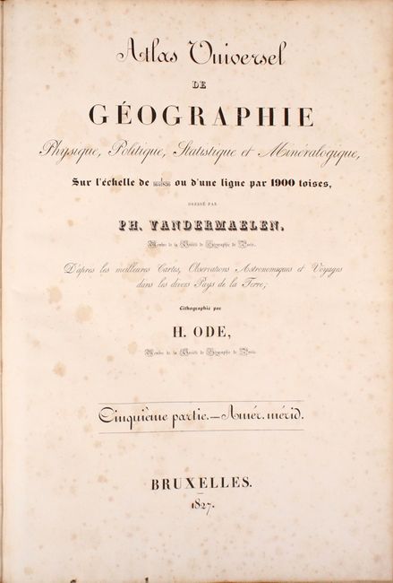
Publication: Atlas Universel
Color: Hand Color
Size:
15 x 21.6 inches
38.1 x 54.9 cm
Vandermaelen was the son of a wealthy industrialist who abandoned his father's business to follow a career in cartography. His goal was to produce the first atlas ever published in which every map was drawn on the same projection and to the same scale (1: 1,641,836), with each map covering an area of approximately 20 degrees of longitude (from Paris) and 6 degrees of latitude. Because of the consistent scale and projection, the maps could be joined together to form a huge globe that would measure over 25 feet in diameter. Vandermaelen had the only known globe constructed from his maps, requiring a special room for its display. It was also the first lithographic atlas ever published. There was one edition of the atlas, published in 1825-27, and the subscription list shows that only 810 copies were sold. Koeman called his Atlas Universel, "One of the most remarkable world atlases ever made. Far ahead of its time."
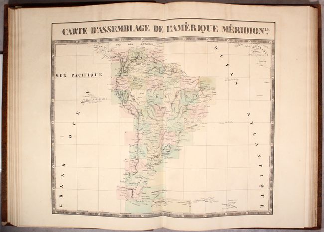
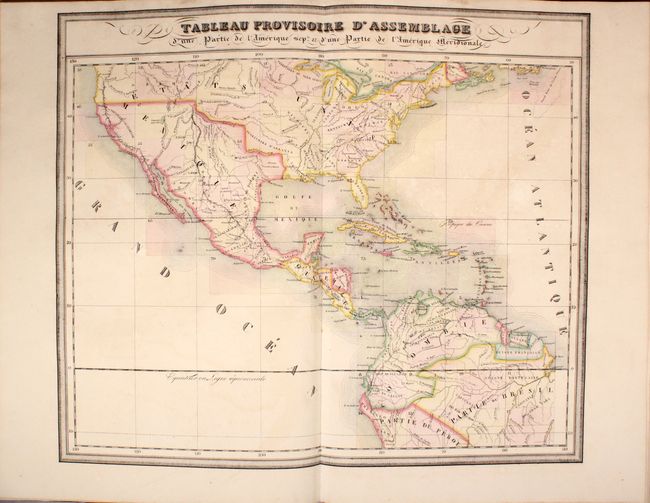
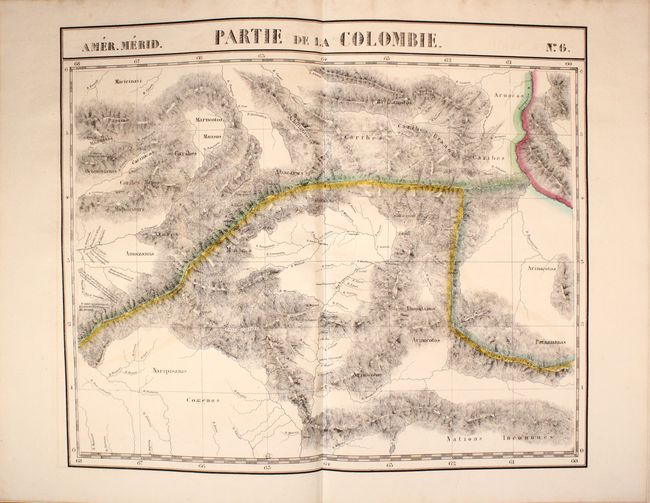
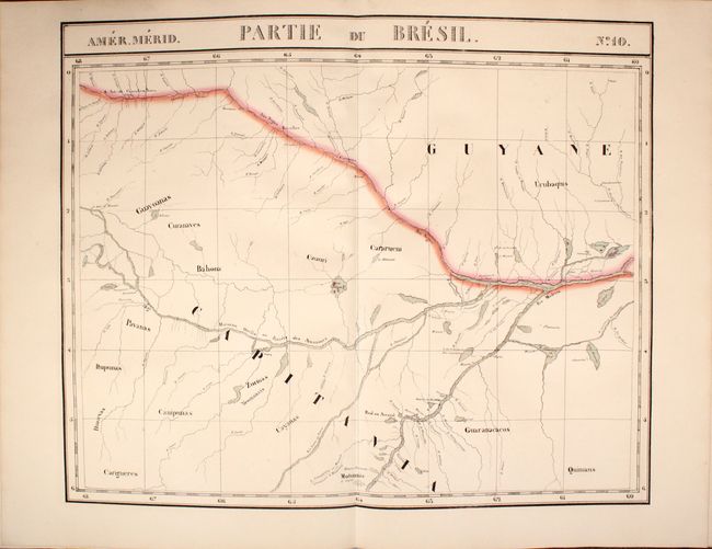
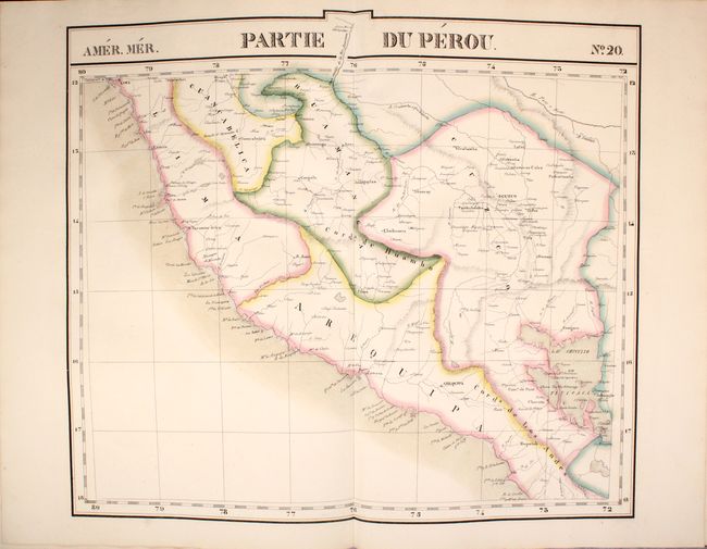
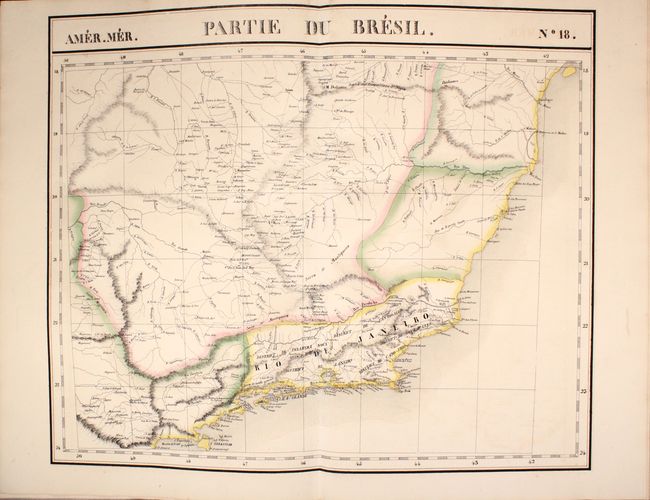
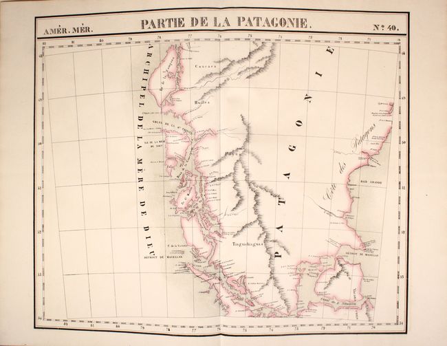
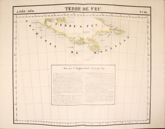
This is a complete and attractive example of Vandermaelen's atlas of South America (volume 5 of 6) with 46 total double-page maps (including two marked No. 4 and No. 16). Each map (approximately 22 x 19") is beautifully hand-colored and contains remarkable detail of each region. The index map, Carte D’Assemblage de L’Americque Meridionle, shows the extent of each map within South America. This index map is normally bound as the first map, but in this example is located before map No. 12. Both the index map and No. 6 map name Parime, although no lake is delineated on either map. Includes detailed maps featuring the Amazon, Lake Titicaca, Tierra del Fuego, and more. An additional unnumbered map is the stunning Tableau Provisoire d'Assemblage… which is a detailed map of North America extending from southern Canada, through Central America and south to beyond the basin of the Amazon River. Mexico controls the Southwest and Texas, which is named.
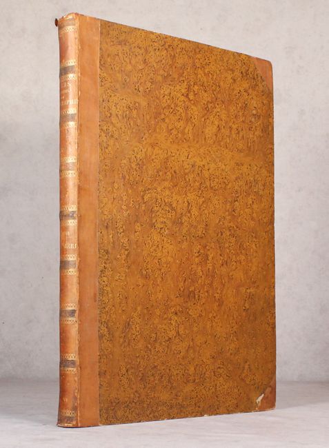
Bound in original brown speckled boards with quarter brown calf on tips and raised ribs and gilt titling on spine. Finely marbled end papers. Two title pages, forty-eight maps. The fine lithography was accomplished from Paris by H. Ode. A rare and remarkable atlas.
Philippe Vandermaelen was the son of a wealthy industrialist who abandoned his father's business to follow a career in cartography. His goal was to produce the first atlas ever published in which every map was drawn on the same projection and to the same scale (1: 1,641,836), with each map covering an area of approximately 20 degrees of longitude (from Paris) and 6 degrees of latitude. Because of the consistent scale and projection, the maps could be joined together to form a huge globe that would measure over 25 feet in diameter. Vandermaelen had the only known globe constructed from his maps, requiring a special room for its display. It was also the first lithographic atlas ever published. There was one edition of the atlas, published in 1825-27, and the subscription list shows that only 810 copies were sold. Koeman called his Atlas Universel, "One of the most remarkable world atlases ever made. Far ahead of its time."
References:
Condition: B+
An attractive example with maps in very good to near fine condition with occasional color offsetting and light toning. Both title pages have scattered foxing with some minor worm tracks along the bottom edge of the sheets. Binding is very good with light wear and rubbing to the tips and edge of the spine.