Subject: Caribbean & Central America
Period: 1847 (dated)
Publication: The London Atlas
Color: Hand Color
Size:
24.5 x 18.5 inches
62.2 x 47 cm
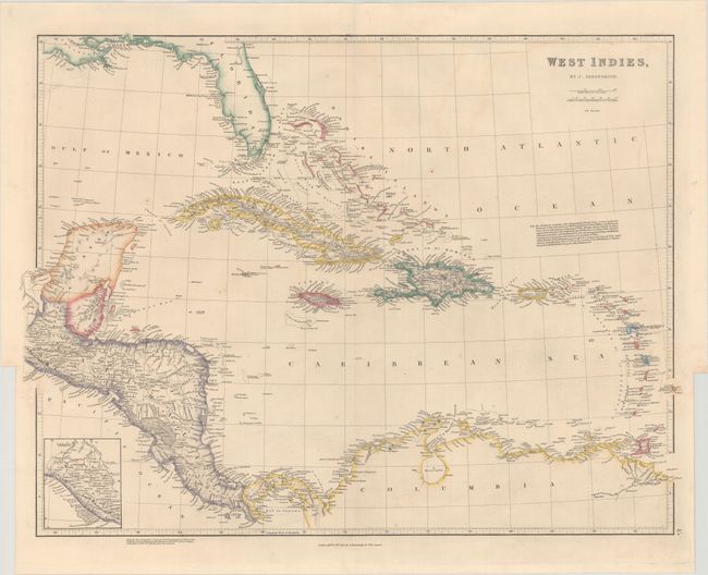
This handsome map focuses on the Caribbean and Central America, giving good inland detail of rivers, lakes, topography and towns. A small inset continues the coast of Guatemala further north; Guatemala encompasses all of El Salvador, Honduras, Nicaragua, and Costa Rica. British Honduras, which later became Belize, is also shown. The remaining areas - Florida, the Yucatan Peninsula, and the northern coast of South America - are defined only along the coasts. The Cape Florida Settlement, which later became Miami, is identified in southern Florida. A note in the Atlantic Ocean explains the different terms for the islands used by Spanish and English mariners.
References:
Condition: B+
Contemporary color with minor toning and soiling.