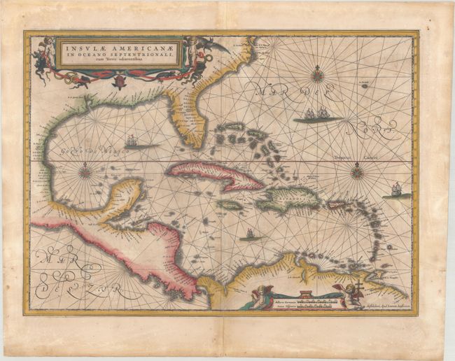
Subject: Gulf of Mexico & Caribbean
Period: 1647 (published)
Publication: Atlas Novus
Color: Hand Color
Size:
20.4 x 14.9 inches
51.8 x 37.8 cm
This handsome map focuses on the West Indies and covers the region from the Chesapeake through the Gulf of Mexico, with Central America and the northern part of South America. Details are confined to the coastlines. Cartographically it is based on the extremely rare chart of Hessel Gerritsz from 1631 and is nearly identical to Blaeu's map of the same title. This is the first state of this map, with Latin text on verso. Lovely title and scale of miles cartouches, rhumb lines, compass roses, and sailing ships make this a very attractive map.
References: Burden #248; Van der Krogt (Vol. I) #9600.1.
Condition: B
Contemporary color that has been partially refreshed with light toning and soiling. There are professional repairs to a few tiny cracks in the image and to several minor separations along the centerfold.