Subject: Philadelphia, Pennsylvania; World's Fair
Period: 1876 (dated)
Publication:
Color: Printed Color
Size:
23.4 x 17 inches
59.4 x 43.2 cm
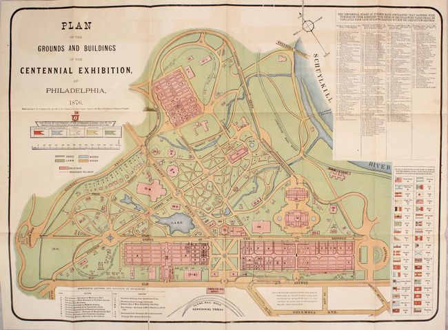
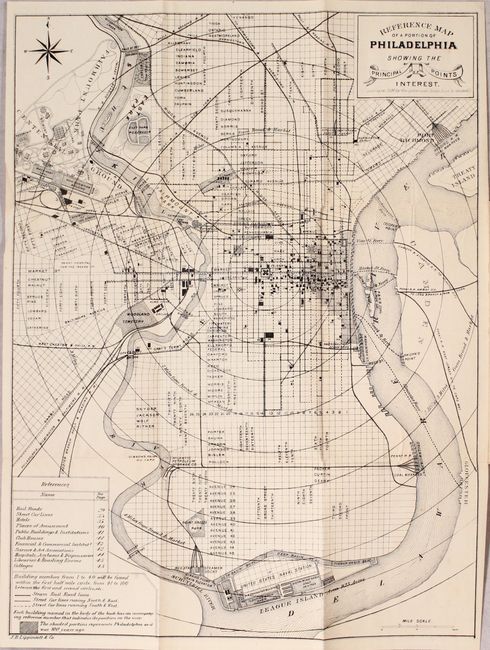
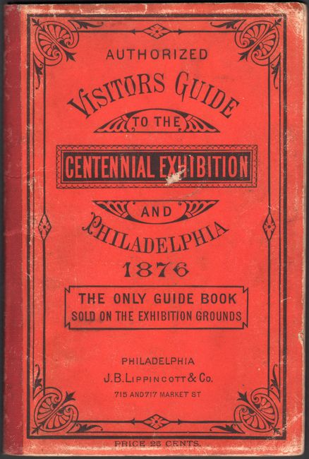
This colorful map details the grounds for the Centennial International Exposition of 1876, the first official World's Fair held in the United States. A table at top right identifies 180 specific buildings on the grounds, and the entrances are located by a reference table at bottom left. The flags of 38 nations involved in the fair are depicted in another table. The map folds out from the back cover of a 48 pp. visitor's guide that includes a program of events and information for travelers. A second map in black & white, Reference Map of a Portion of Philadelphia Showing the Principal Points of Interest (12.1 x 16.0") folds out of the front cover. Published by J.B. Lippincott & Co.
References:
Condition: B+
The map of the grounds has several fold separations and short tears along with light offsetting that is more predominant along the top border. The other map has a few minor spots. Paper wrappers have light wear and there is minor scattered foxing in the text.