Subject: Pennsylvania
Period: 1793-1800 (circa)
Publication:
Color: Black & White
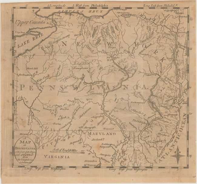
A. A Map of Pensylvania, with Part of the Adjacent States, from the Latest Surveys, by Jedidiah Morse, from Morse's Geography, circa 1793 (8.1 x 7.4"). Scarce map of Pennsylvania that includes part of the surrounding states, with all of New Jersey. The names of Lake Geo., Oneida Lake and Lake Ontario are engraved upside down and the Susquehanna River is nearly so. Buffalo Swamp is shown in Western New York. The Northeast Branch of Susquecherry Val[ley] is named. The Erie Triangle is shown in New York. A second label for Oneida Lake is correctly printed right-side up. Engraved by Osgood Carleton. Condition: Issued folding with light toning, minor foxing, and printer's ink residue. (B)
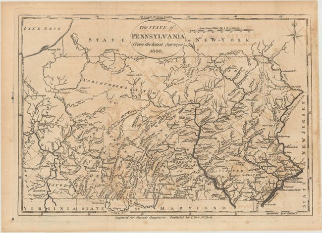
B. The State of Pennsylvania from the Latest Surveys, by I. Low, from Payne's Goegraphy, dated 1800 (10.5 x 7.2"). This is a reduced version of John Reid's map of 1796, which was the first map to use the correct New York/Pennsylvania boundary. Allegany is listed for both the County and River. The West branch of the Schuylkill, Little Schuylkill, and Potomac rivers are shown. The detail includes topography, towns, donation lands, counties and townships, as well as remarkable network of early roads. Condition: Issued folding with some offsetting. (B+)
References:
Condition:
See description above.