Subject: Oklahoma
Period: 1879 (dated)
Publication: Sen. Ex. Doc. No. 50, 48th Congress, 2nd Session
Color: Hand Color
Size:
22 x 15.1 inches
55.9 x 38.4 cm
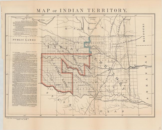
A desirable map depicting the territory with the first designation of Public Lands. Included in a panel to the side of the map are two fascinating letters concerning the disposition of the Public Lands within the territory. The first, by Congressman Augustus Albert contains a list of questions. The answers, by Col. E.C. Boudinot, attempt to "set the records straight" by detailing how the land was acquired from the Indians, its current status, and directions to "several million acres of the richest land on the continent." A number of Army forts are named and located. A significant and important map for any Oklahoma collection.
References:
Condition: A
Issued folding with just a hint of toning along the folds.