Subject: New York City, New York
Period: 1871 (published)
Publication:
Color: Hand Color
Size:
20.5 x 13.5 inches
52.1 x 34.3 cm
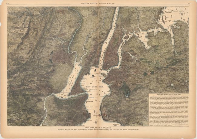
This detailed view shows New York City and its surroundings from the vantage of "somewhere in mid-air above Fort Hamilton, at the outset of the Narrows, from which convenient height [the viewer] can cast his eye over all the country lying within a radius of eighteen miles around New York." Published on May 6, 1871 in a supplement edition of Harper's Weekly, it was part of the trend of hot air balloon views popularized in the United States during the Civil War. The cityscape and topography are rendered in fine detail. The map extends into New Jersey, showing Jersey City, Newark, Paterson, and more. There is a block of text at bottom right that comments on the rapid transit system already in place in the region. It also mentions the Brooklyn Bridge, then under construction, and predicts that "at some future day a tunnel under the Hudson" may connect New Jersey and Manhattan, anticipating the Holland Tunnel decades before its planning and construction.
References:
Condition: B+
There is light toning largely confined to the sheet's edges and several separations and tears along the centerfold, which has been backed on verso with archival tape. A small tear obscures part of Ft. Lafayette.