Subject: Key West, Florida
Period: 1884 (dated)
Publication:
Color: Black & White
Size:
34.4 x 24.6 inches
87.4 x 62.5 cm
The Office of Coast Survey is the oldest U.S. scientific organization, dating from 1807 when Congress directed that a "survey of the coast" be carried out. By 1836, it was called the U.S. Coast Survey and in 1878, the name was changed to the U.S. Coast and Geodetic Survey. Today the Office of Coast Survey is a division of the National Oceanic and Atmospheric Administration NOAA.
The survey teams, composed of civilians as well as Army and Naval officers, charted the nation's waterways and produced a wide array of reports, survey charts, hydrographic studies of tides and currents, astronomical studies and observations, and coastal pilots. These charts are an important record of the changing nature of the nation's coastlines. In additional to coastal charts, the U.S. Coast and Geodetic Survey produced land sketches, Civil War battle maps, and the early aeronautical charts.
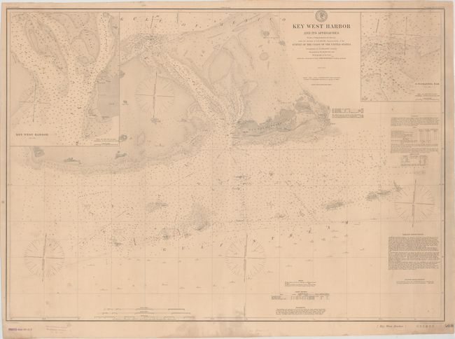
This is an updated version of a chart that first appeared in 1855. This version was issued in 1884 with a stamp in the bottom left margin indicated it was updated to 1892. The detailed chart covers the area from Stock Island and Key West to Boca Grande Key in the west. Features detailed navigational information in the vicinity including buoys, light houses, numerous soundings, and navigational instructions. Inset maps of Key West Harbor and N.W. Channel Bar provide additional insight.
References:
Condition: B+
Overall light toning with some scattered minor staining.