Subject: Yosemite, California
Period: 1896-1906 (dated)
Publication:
Color:
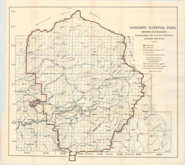
A. Yosemite National Park Showing Boundaries Established by Act of Congress Approved June 11, 1906, by U.S. Government, dated 1906, printed color (27.1 x 24.7"). This colorful map illustrates the new boundaries of Yosemite National Park with the incorporation of the Yosemite Valley Grant near the middle of the park and the Big Tree Grant at bottom. It contains considerable detail on a scale of 2 miles to the inch. A legend provides an explanation of symbols including existing and suggested trails, roads, and patrol stations. Condition: Issued folding with a hint of offsetting.
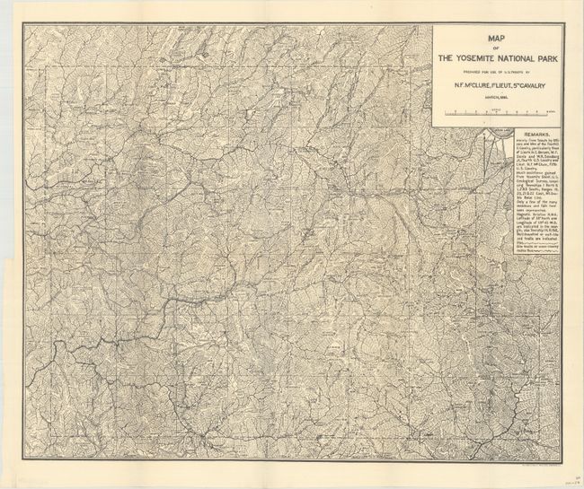
B. Map of the Yosemite National Park Prepared for Use of U.S. Troops by N.F. McClure, 1st Lieut., 5th Cavalry, by U.S. Army, dated 1896, black & white (19.9 x 16.3"). This very detailed and important map was made shortly after the establishment of Yosemite as a protected park in 1890. During this period, the Army's Fifth Cavalry Regiment controlled the park, and this map was made for their use. The map is filled with information on trails, cabins, camps and meticulous notes on topography. Prepared by N.F. McClure, 1st Lieut., 5th Cavalry. Condition: Issued folding with a hint of toning along the folds.
References:
Condition: A
See description above.