Subject: North America, Texas
Period: 1846 (circa)
Publication:
Color: Hand Color
Size:
9.4 x 13.7 inches
23.9 x 34.8 cm
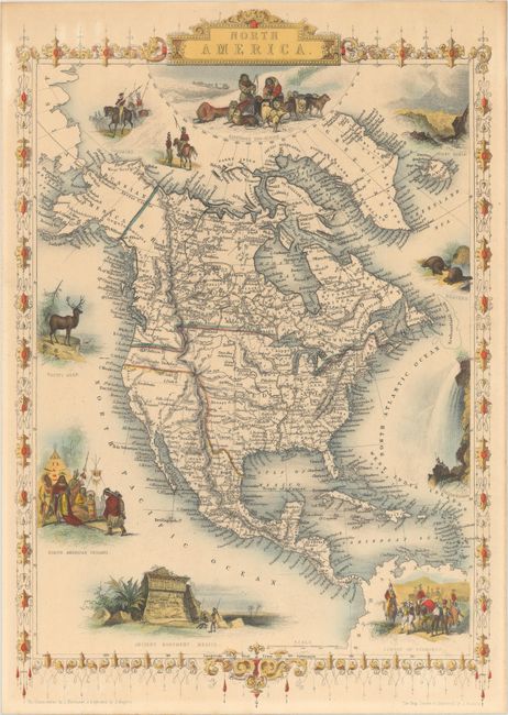
This uncommon map is nearly identical to the later version published by John Tallis, and features Texas shown with an enlarged panhandle that extends into New Mexico and Colorado. The boundary between Canada and the United States reflects British claims in the Oregon Territory with a line fixing the boundary south of the Columbia River. Mexico is still in control of California and the Southwest. The map is filled with forts and locates many Indian tribes. Alaska is Russian America. Several lovely vignettes appear around the continent, including Wapiti Deer, Beavers, North American Indians, Ancient Monument, Mexico, and Convoy of Diamonds. Across the top are images of Russian Cossacks (representing the Russian Possessions in Alaska), an Eskimo dog sled, and Mount Hekla, Iceland. The map was drawn and engraved by J. Rapkin; the vignettes were drawn by J. Marchant and engraved by J. Rogers. Surrounded by a delicately engraved and decorative border.
References:
Condition: A
There is a hint of toning at top, otherwise fine.