Subject: New Caledonia
Period: 1825-27 (published)
Publication: Atlas Universel de Geographie...
Color: Hand Color
Size:
21.1 x 18.5 inches
53.6 x 47 cm
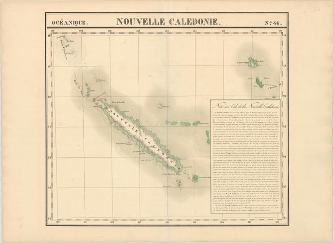
Vandermaelen was the son of a wealthy industrialist who abandoned his father's business to follow a career in cartography. His goal was to produce the first atlas ever published in which every map was drawn on the same projection and to the same scale (1: 1,641,836), with each map covering an area of approximately 20 degrees of longitude (from Paris) and 6 degrees of latitude. Because of the consistent scale and projection, the maps could be joined together to form a huge globe that would measure over 25 feet in diameter. Vandermaelen had the only known globe constructed from his maps, requiring a special room for its display. It was also the first lithographic atlas ever published. There was one edition of the atlas, published in 1825-27, and the subscription list shows that only 810 copies were sold. Koeman called his Atlas Universel, "One of the most remarkable world atlases ever made. Far ahead of its time."
This map centers on the French territory of New Caledonia and extends northeast to include several islands from Vanuatu. A large block of text describes the island.
References:
Condition: A+
Contemporary color on a clean, bright sheet.