Subject: Southern Africa
Period: 1855-58 (dated)
Publication:
Color: Hand Color
This lot features four maps showing 19th century explorations in southern Africa:
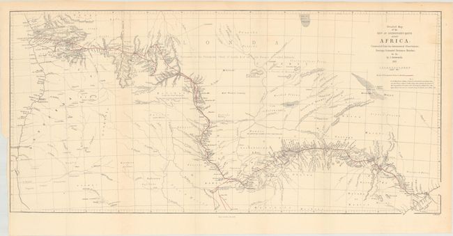
A. Detailed Map of the Revd. Dr. Livingstone's Route Across Africa..., by John Arrowsmith, dated 1857 (24.9 x 11.9"). This map shows the route of Dr. David Livingstone across southern Africa. Livingstone was the first European to make a transcontinental trek across the continent, and his two year journey (1854-56) depicted here took him from Luanda, Angola to Quelimane, Mozambique. Condition: Issued folding with pleasant light toning. (B+)
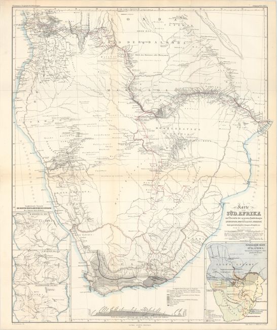
B. Karte von Sud-Afrika zur Ubersicht der Neuesten Entdeckungen von Livingstone, Moffat, Galton, Anderson..., by Augustus Herman Petermann, dated 1858 (17.3 x 20.9"). This very detailed map features the explorations of Dr. Livingstone with his routes (1841-56) throughout the region shown in red and extending from Cape Town through the interior and out to both coasts. The explorations of Gamitto (1831), Moffat (1854), Galton (1850-1851), and Anderson (1851-1853) are also delineated. A large inset at lower right uses color and line to identify the location of the Hottentots; Betschuana; Kifir; Neger-Stajmme; Gemischte; Betschuanen u. Kafir and other peoples. Three insets at left present the geography of central Africa per H. Kiepert, Nov. 1855; J. McQueen, March 1857; and D. Livingstone, Nov. 1857. At lower center is a geological profile of the continent with the legend identifying 10 types using different patterns. Condition: A clean and colorful example with a hint of toning along the fold lines. (A)
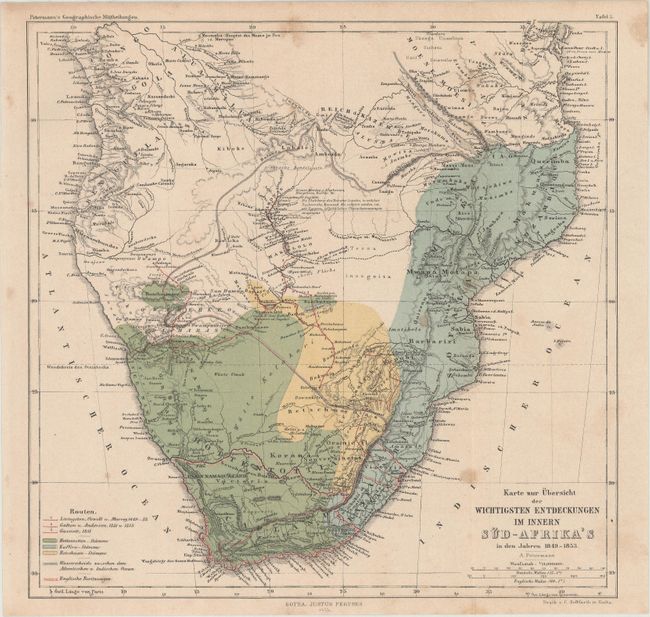
C. Karte zur Ubersicht der Wichtigsten Entdeckungen im Innern Sud-Afrika's in den Jahren 1849-1853, by Augustus Herman Petermann, from Petermann's Geographische Mittheilungen, dated 1855 (10.1 x 9.9"). A smaller Petermann map of Southern Africa color-coded to show the various native populations along with the routes of Livingston, Galton and Gassiott. Condition: Light toning with a few spots of foxing in the image. (B+)
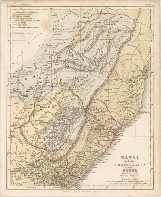
D. Natal und die Freistaaten der Boers..., by Hermann Berghaus, from Petermann's Geographische Mittheilungen, dated 1855 (7.9 x 9.9"). Focused on southeastern Africa, this small map is also color-coded to show the various native groups with the routes of explorers in outline color. Condition: Light scattered foxing. (B+)
References:
Condition:
See description above.