Catalog Archive
Auction 172, Lot 690

"[On 2 Sheets] Carte Particuliere de la Cote Occidentale de l'Afrique Depuis le Cap Blanc Jusqu'au Cap de Verga, et du Cours des Rivieres de Senega et de Gambie...", Anville, Jean Baptiste Bourguignon d'

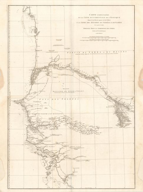
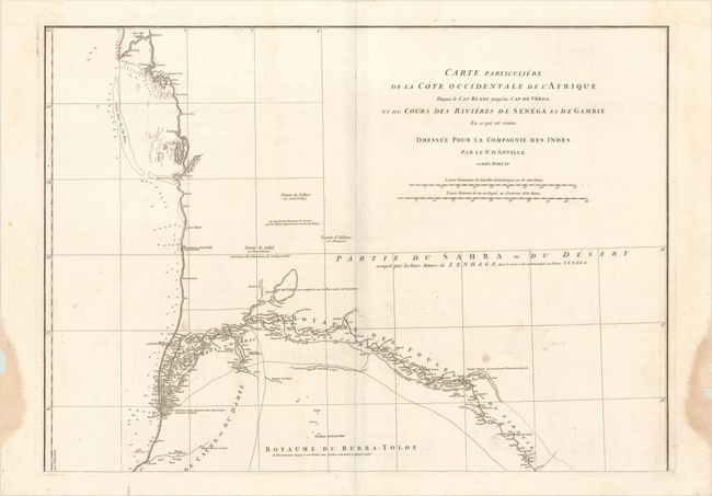
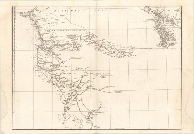
Subject: Western Africa

Period: 1751 (dated)

Publication:

Color: Black & White

Size:
27.6 x 19.8 inches
70.1 x 50.3 cm
Download High Resolution Image
(or just click on image to launch the Zoom viewer)

Printed on two elephant folio sheets, this map depicts the western coastline of Africa from Mauritania to Guinea-Bissau, including Senegal and Gambia. Particular attention is paid to the Gambia and Senegal Rivers, which are nearly the only details that appear inland. Short notations are scattered throughout, with information on the natives, topography and resources. Engraved by Guillaume de la Haye.

References: Shirley (BL Atlases) T-ANV-2a #30-31.

Condition: B+

Dark impressions on watermarked paper with faint offsetting and a few minor spots in the image. The top sheet has dampstains confined to the side margins, while the lower sheet has some side margin reinstatement. Please note that the first image is a composite image - the map is in two separate sheets.

Estimate: $200 - $230

Sold for: $150

Closed on 4/17/2019

Archived