Subject: Western Africa
Period: 1639 (circa)
Publication:
Color: Hand Color
Size:
19.4 x 13.6 inches
49.3 x 34.5 cm
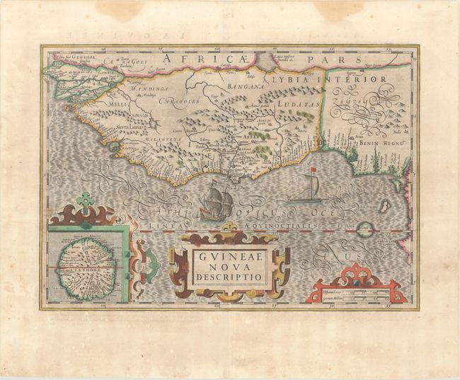
This beautifully engraved map of western Africa covers the region from Senegal, Rio Senega, to Cape Lopez on the Gulf of Guinea just below the equator. The map reflects the Portuguese exploration and settlement in the region and includes a large inset of the Island of St. Thomas. This is one of six new maps of Africa to be included in Hondius' editions of Mercator's Atlas. It is beautifully embellished in Hondius' style with strapwork title cartouches, a Portuguese ship and native sailing boat, and fully engraved seas in a moiré style. French text on verso, published between 1639-44.
References: Norwich #316; Van der Krogt (Vol. I) #8700:1A.
Condition: B+
A dark impression with a hint of toning and a centerfold separation that just enters the image at bottom and has been closed on verso with archival material. A pair of dampstains are confined to the top blank margin.