Subject: Western Africa
Period: 1597 (circa)
Publication: Petits Voyages, Part I
Color: Black & White
Size:
15 x 12.1 inches
38.1 x 30.7 cm
This copper engraving is from a remarkable series of publications, illustrating voyages of discovery and travels of exploration to various parts of the world. The project was begun by Theodore de Bry of Frankfurt, in 1590 and was to continue for another 54 years. They became known collectively as the Grands Voyages (to America and the West Indies) and the Petits Voyages (to the Orient and the East Indies). De Bry died after the first six parts of the Grands Voyages were completed. The project was completed initially by his widow and two sons, Johann Theodore de Bry and Johann Israel de Bry, then by Johann Theodore's son-in-law, Matthaus Merian, in 1624.
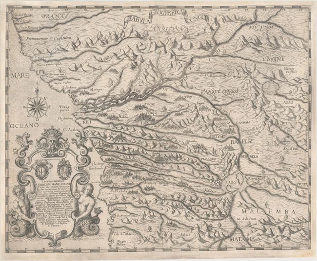
Boldly engraved map of the Congo region of the West African coast from just south of the equator to present-day Angola with a highly conjectural Congo river system. Dramatic topography and imaginary cities are depicted and the map is adorned by an elaborate title cartouche and a compass rose. The map accompanied a description by Pigafetta of Eduardo Lopez's visit to the region in 1578.
References: Garratt (TMC-9) pp. 9-10.
Condition: B+
Issued folding on a watermarked sheet that has been professionally remargined on all sides to better accommodate framing. Expertly conserved to repair a number of small fold separations and a 9" tear at left.