Subject: Melilla, Morocco
Period: 1793 (dated)
Publication:
Color: Hand Color
Size:
21.5 x 13.3 inches
54.6 x 33.8 cm
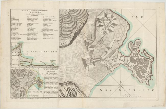
This rare map details the autonomous Spanish city of Melilla, which shares a border with Morocco. The city is shown in plan form, with a key at top left that identifies 56 places of interest. There is fine topographical detail surrounding the city. In an odd printing error, Mar Mediterraneo is printed in reverse. Two insets at left zoom out to provide greater context. The inset at top shows more of the Western Mediterranean and Africa, while the inset at bottom extends to depict more of the surrounding countryside. The key and insets and the proper map are printed on two separate sheets, joined together here, possibly for a composite atlas.
Don Tomas Lopez de Vargas Machuca (1730-1802) was Geographer to the King of Spain and one of the most distinguished Spanish cartographers of the eighteenth century.
References:
Condition: A
On paper with a fleur-de-lis coat of arms and a hint of offsetting.