Subject: Africa
Period: 1660 (circa)
Publication:
Color: Hand Color
Size:
20.7 x 16.7 inches
52.6 x 42.4 cm
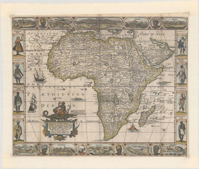
This scarce and splendid carte-a-figures map is a very close copy to Visscher's 1652 map of the continent, which in turn is based upon Pieter Van Den Keere's map of 1614. The general shape of the continent and the river systems follow Van Den Keere including the unnamed Spirito Santo and Cuama rivers flowing from a common source, as well as the unnamed Zambere River originating in Sachaf Lake. Place names on the map have been translated from Latin into English, with the twin lakes of Zaflan and Zair being the source of the Nile. Above and below the map are views of various African cities including Tangier, Algiers, and the Santa Cruz de Tenerife. These views were largely based upon Braun & Hogenberg. Flanking the map at left and right is a series of costumed figures including a woman of Fez, a Guinean, and a Abissine woman. The map is further decorated by an ornate title cartouche featuring a native atop a crocodile, sailing ships, and several fierce-looking sea monsters in the oceans.
References: Betz #88.2; The Map Collector #17 pp. 48-49.
Condition: B+
Originally issued folding on watermarked paper and now flattened and backed with tissue to reinforce and repair a number of small fold separations. The margins have been extended with tissue all around to accommodate framing.