Subject: India
Period: 1768 (dated)
Publication:
Color: Hand Color
Size:
54.6 x 22.1 inches
138.7 x 56.1 cm
Thomas Jefferys was one of the most important English map publishers of the 18th century. His work included prints and maps of locations around the world, but his most notable maps are of North America and the West Indies. He began his career in the map trade in the early 1730s, working as an engraver for a variety of London publishers, and eventually setting up his own shop. In 1746, he was appointed Geographer to the Prince of Wales, and in 1760 he became Geographer to the King. These titles granted access to manuscripts and cartographic information held by the government. In the early 1760s he embarked on an ambitious project to produce a series of English county maps based on new surveys, but ran out of money and filed for bankruptcy in 1766. He then partnered with London publisher Robert Sayer, who reissued many of Jefferys plates and continued to issue new editions after Jefferys' death in 1771. Jefferys' American Atlas and the accompanying West-India Atlas, published post posthumously, are considered his most important cartographic works.
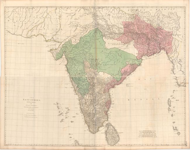
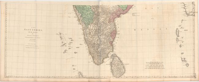
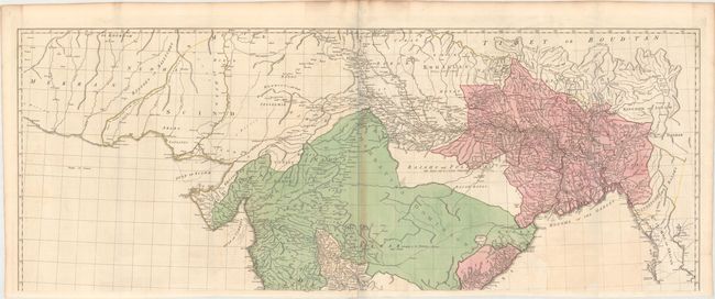
This impressive, large-scale map of India portrays the most up-to-date knowledge of the region for the mid-eighteenth century, prior to the Alexander Dalrymple maps of India in the 1770s. Dedicated to the Directors of the East India Company, the map depicts great detail in southern India and the area of Bahar Benga. Roads, caravan routes, oases, temples, political boundaries, archeological sites, and the topography of the land are all well depicted. By contrast there is very little information in central and northern India, which are noted as "little known and in a manner independent." This is the second edition, published by Robert Sayer. On four sheets, joined into two horizontal pairs each measuring approximately 55 x 22". If joined, the map would measure 55 x 44".
References:
Condition: B+
Contemporary color with light offsetting. The top sheet has some light toning along the centerfold. Issued folding. Please note that the first image is a composite image - the map is in two separate sheets.