Subject: Southwestern China
Period: 1737 (circa)
Publication: Description Geographique Historique... de l'Empire de la Chine et de la Tartarie Chinoise
Color: Hand Color
Size:
17.3 x 14.6 inches
43.9 x 37.1 cm
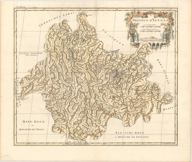
This map of the Yunnan province is fully engraved with towns, rivers, mountains, and lakes. The maps from Du Halde's atlas were assembled by D'Anville and compiled from an extensive Jesuit survey carried out in 1708-16 for the Emperor Kang-Shi. It remained the principal cartographical authority on China during the rest of the 18th century. The missionaries used local sources and personal observation to prepare these incredibly detailed maps. Attractive figurative title cartouche complements the detailed map. Engraved by Delahaye.
References: Shirley (BL Atlases) T.HALD-1a #17.
Condition: A
A sharp impression on paper with a bunch of grapes watermark, issued folding with faint offsetting mostly visible in the top blank margin, and a hint of toning along the edges of the sheet.