Subject: Northern China
Period: 1737 (circa)
Publication: Description Geographique Historique... de l'Empire de la Chine et de la Tartarie Chinoise
Color: Hand Color
Size:
9.9 x 14 inches
25.1 x 35.6 cm
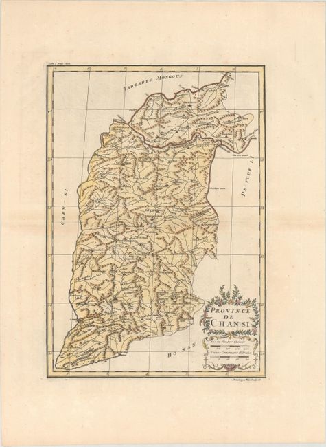
This is an important map of Shansi (Shanxi) province, southwest of Beijing. Shanxi's name literally means "mountains' west," which are vividly depicted on the map. The Great Wall forms much of the northern boundary and partially encloses part of the Sixteen Prefectures, a strategic region vital to guarding the Chinese heartland from the steppe tribes to the north. The maps from Du Halde's atlas were assembled by D'Anville and compiled from an extensive Jesuit survey carried out in 1708-16 for the Emperor Kang-Shi. It remained the principal cartographical authority on China during the rest of the 18th century. The missionaries used local sources and personal observation to prepare these incredibly detailed maps. Attractive figurative title and scale of miles cartouches complement the detailed map. Engraved by Delahaye.
References: Shirley (BL Atlases) T.HALD-1a #11.
Condition: B+
A sharp impression on paper with the watermarks of "C Richard Auvergne" and a bunch of grapes. There is faint offsetting and minor toning along the centerfold.