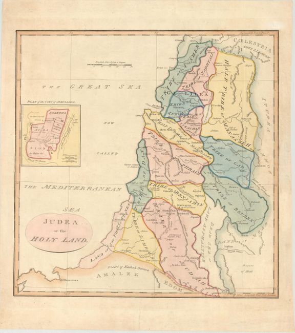
Subject: Holy Land
Period: 1790 (circa)
Publication: An Universal Atlas
Color: Hand Color
Size:
14.4 x 14.5 inches
36.6 x 36.8 cm
This English map of the Holy Land shows the division among the Tribes on both sides of the Jordan River with the shoreline running from Sidon (Sayda) to Rhinocorura (El Arish). Gaza is noted as the Land of the Philistines. The Bay of Acco is enlarged and Haifa is absent. A small plan of the ancient city of Jerusalem is inset at left. The map was first published Dec. 1, 1782; this edition is undated.
References: Laor #747.
Condition: B+
On a bright sheet of paper with the watermark of "J. Whatman 1822." There is a light damp stain at far right, entering the map image less than 2" and an archivally repaired tear in the bottom blank margin.