Subject: Middle East
Period: 1753 (dated)
Publication: Atlas Universel
Color: Hand Color
Size:
24.4 x 18.6 inches
62 x 47.2 cm
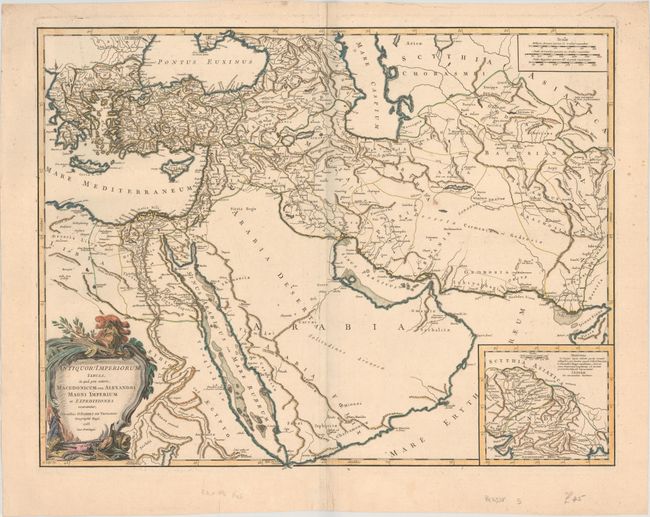
This is the first state of this large map of the ancient empires of the Middle East. This finely engraved map is centered on Arabia and extends to the Caspian Sea in the north, west to show Greece, east to the Indus River, and south to include all the Red Sea and the Nile River valley. There is good detail of topography, deserts, towns, and villages, etc. The interior of Arabia is very nearly blank. The campaigns of Alexander the Great (356-323 B.C.) are traced. A large inset shows northern India from the Indus River and the region of the Asiatic Sythians, with notes on Alexander the Great’s expeditions. Elisabeth Haussard engraved the large title cartouche that is embellished with military accoutrements. It was published in 1757 as part of the first edition.
References: Pedley #382.
Condition: B+
A nice impression on paper with windmill watermark, minor foxing mostly confined to the blank margins, and a 1"tear adjacent to the centerfold in Arabia that has been archivally repaired.