Subject: Malta
Period: 1784 (circa)
Publication: Histoire Universelle...
Color: Black & White
Size:
13.4 x 9.3 inches
34 x 23.6 cm
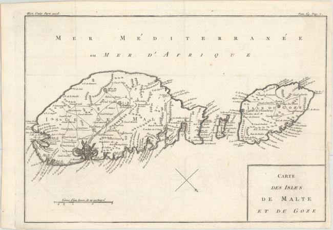
This handsome map of the islands of Malta and Gozo (Ghawdex) presents excellent detail of the towns, fortifications, roads and anchorages. The Wignacourt Aqueduct is prominently shown flowing from the interior springs at Dingli and Rabat to Valetta, and served as the capital city's water source until the 20th century. North is oriented to the bottom right, with a simple block-style cartouche decorating the map.
References:
Condition: A
Issued folding with a printer's crease at bottom left, a hint of offsetting, and an archivally repaired chip and tear in the right blank margin. The right margin is narrow, but still sufficient for framing.