Subject: Balearic Islands
Period: 1740 (circa)
Publication:
Color: Hand Color
Size:
22.1 x 16.4 inches
56.1 x 41.7 cm
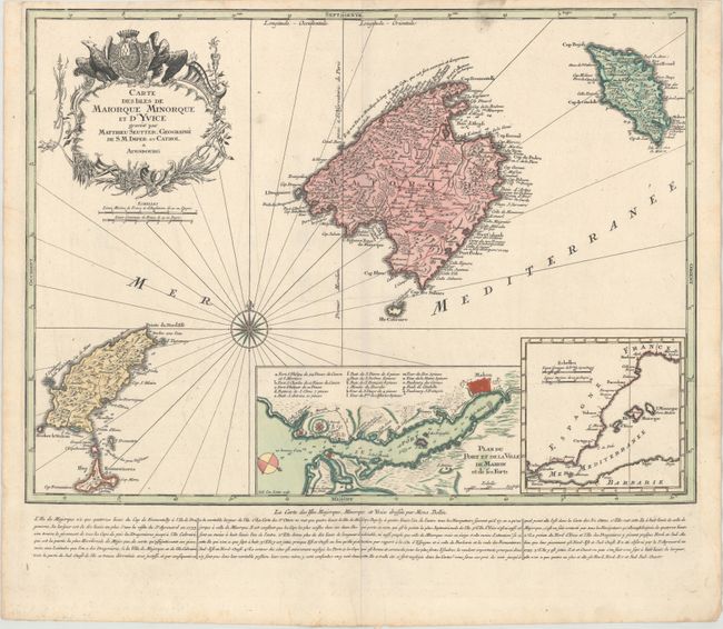
Fine copper engraved map of the Spanish Balearic Islands based on Bellin, with good detail of towns, roads, and topography on each of the islands. A large inset at bottom center depicts the port and city of Mahon on the island of Menorca, with a lettered key identifying numerous locations. At bottom right is an inset showing the location of the Balearic islands in relation to Spain and the Mediterranean. A decorative title cartouche, a compass rose, and rhumb lines make this a handsome chart. French text below map gives navigational information regarding the islands.
References:
Condition: A
A nice impression with contemporary color on paper with a watermark of the initials "IS." There is a smudge of printer's ink residue at top and light toning along the edges of the sheet.