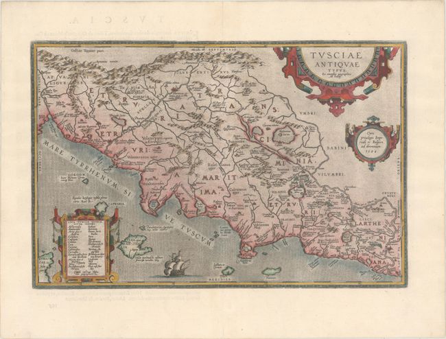
Subject: Central Italy
Period: 1584 (dated)
Publication: Theatrum Orbis Terrarum
Color: Hand Color
Size:
19.4 x 12.8 inches
49.3 x 32.5 cm
Stunning map of ancient Tuscany based on Bellarmati's map supplemented by classical sources. Includes numerous small islands off the coast, as well as a bit of northern Corsica. Adorned with three strapwork cartouches and a galleon. This is the first plate with the ship sailing westward, which was replaced in 1592 with a new plate with an eastward sailing ship. Latin text on verso, published in 1584.
References: Van den Broecke #207.
Condition: A
A dark impression on a clean, bright sheet with the crossed arrows watermark commonly found on Ortelius' maps, with light printer's ink residue and a couple of tiny wormholes along the centerfold at bottom that have been professionally infilled.